

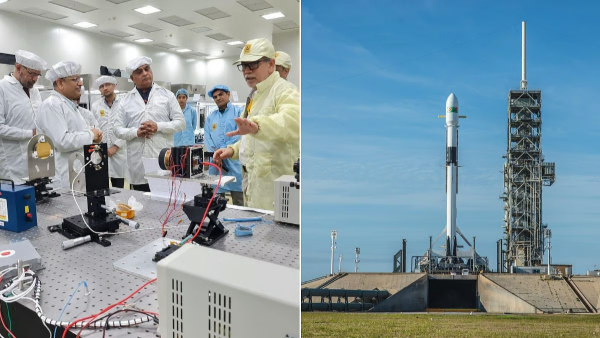
India’s private space sector has added another technology demonstration to its growing list of orbital missions, with Ahmedabad-based SatLeo Labs’ TAPAS-1 thermal imaging payload launched aboard a SpaceX Falcon 9 as part of the Transporter-18 rideshare mission.
The Falcon 9 lifted off from Vandenberg Space Force Base in California on October 1, carrying around 130 payloads into orbit. TAPAS-1 is India’s first private commercial thermal-imaging payload and has been developed by SatLeo Labs for applications based on thermal data collected from space.
The payload has been placed in an orbit about 500 kilometres above Earth. It uses thermal infrared sensing to capture variations in temperature across the planet’s surface.
Unlike conventional optical imaging, thermal imaging can identify differences in heat that may not be visible in ordinary photographs. SatLeo plans to use the data for applications including agriculture, urban heat monitoring, water-stress assessment, disaster management and infrastructure monitoring.
The technology could help identify areas experiencing unusually high temperatures, monitor crop and water stress and provide information during events such as forest fires.
The company has also worked with the Ahmedabad Municipal Corporation on a pilot project involving urban temperature mapping.
TAPAS-1 weighs about 1.5 kilograms and belongs to the CubeSat category. The company says the payload will remain in orbit for about three years, during which the data will be used to develop commercial applications.
SatLeo Labs is planning additional satellites, including TAPAS-2, as part of its expansion of thermal-imaging capabilities.
The mission is part of a broader expansion of India’s private space ecosystem following policy changes that opened greater opportunities for non-government entities in space activities.
The latest launch demonstrates how Indian startups are developing specialised satellite technologies for applications on Earth, combining space-based sensing with artificial intelligence and data analytics.

Comment here